The methods and technical skills that I have developed during my time in graduate school include statistical data analysis; geographic information systems (GIS); survey, workshop, and interview design and analysis; roadway safety evaluation; asset managment project scheduling and budget allocation; and simulation techniques including network modeling and methods such as agent-based modeling and discrete event simulation.
Outside of research, I have a passion for teaching. I have served as a TA and Grader for multiple undergraduate civil engineering courses. I have given guest lectures in both undergraduate and graduate civil engineering courses on the topics of resilience and infrastructure management and resource allocation. For a complete record of my publications, presentations, work experience, and teaching background, please see my CV. The following provides an overview of some recent research topics that I have been working on.
AIS Vessel Tracking Data
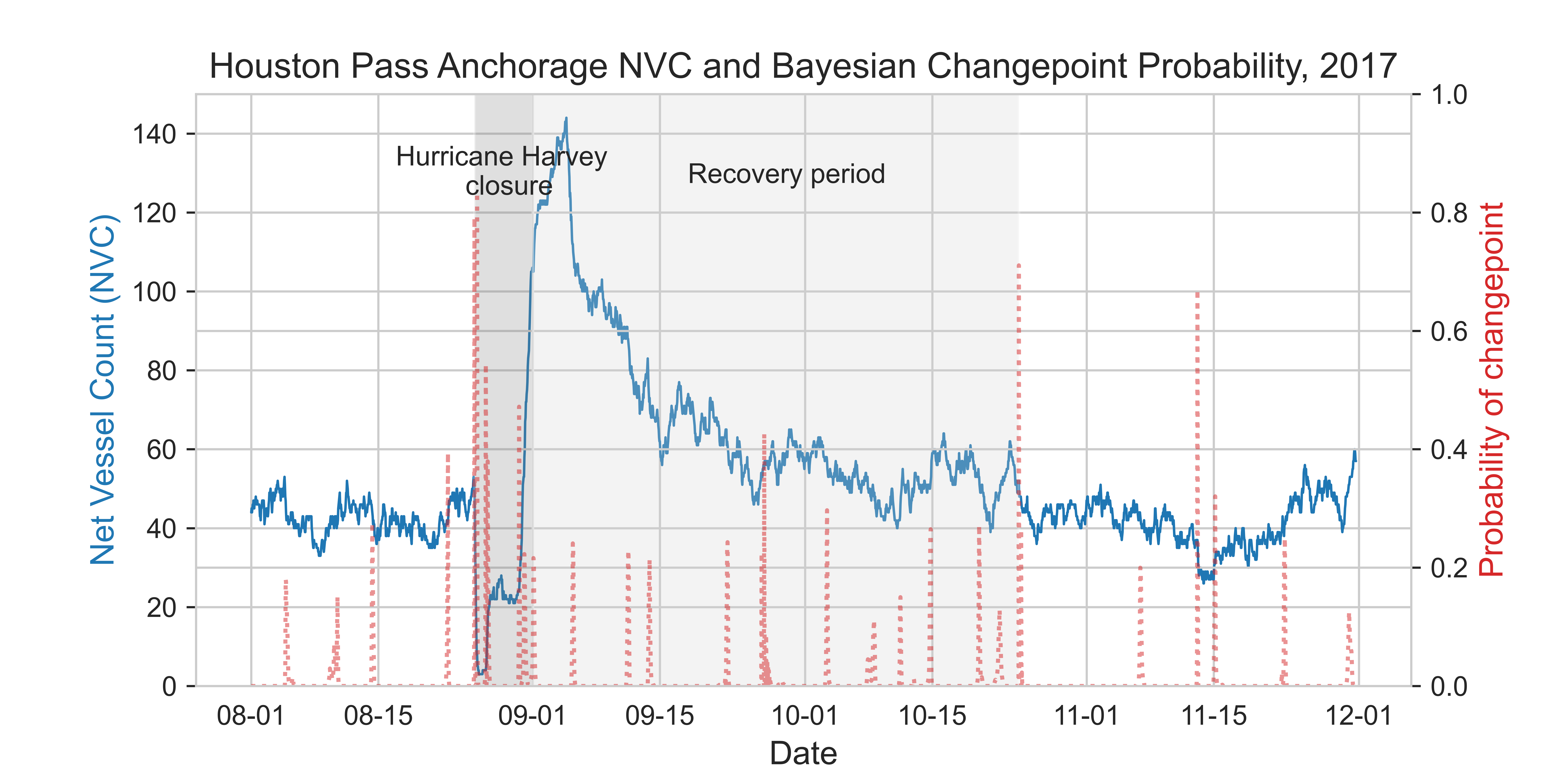
Automatic Identification System (AIS) data provides time and location information for maritime vessels. While AIS is most commonly used as a real-time tracking aid for vessels on the water, archived historical AIS datasets are a rich resource for a wide variety of freight transportation assessments. In a paper, "Quantitative Analysis of Hurricane Harvey Impacts on Texas Maritime Facilities," published in the Transportation Research Record, I used AIS data to examine the impact that Hurricane Harvey had on actual vessel movements in the Port of Houston in 2017. Our study found that the net vessel count (NVC), an indicator of queuing in the system, increased dramatically after Harvey, as shown in the image. The observed behavior of the NVC in the Houston anchorage strongly displays characteristics of the famed "resilience triangle," where an infrastructure system experiences a performance perturbation due to a disruptive event, which gradually returns to normal levels as functionalities are restored.We conducted numerous statistical tests and distribution fits to examine the impact that Hurricane Harvey had on vessel wait times at anchorage and dwell times in port. The findings indicate that Harvey had a significant, disruptive impact on vessel operations at the Port of Houston. Finally, a Bayesian changepoint detection algorithm was used to identify breaks in the data and find when operations returned to normal. This analysis showed that the disruption on the Port of Houston lasted two months before the systems' queuing reaching typical levels. To read about the full methods and results, please see the complete TRR publication manuscript.
Port Risk and Resilience Assessment
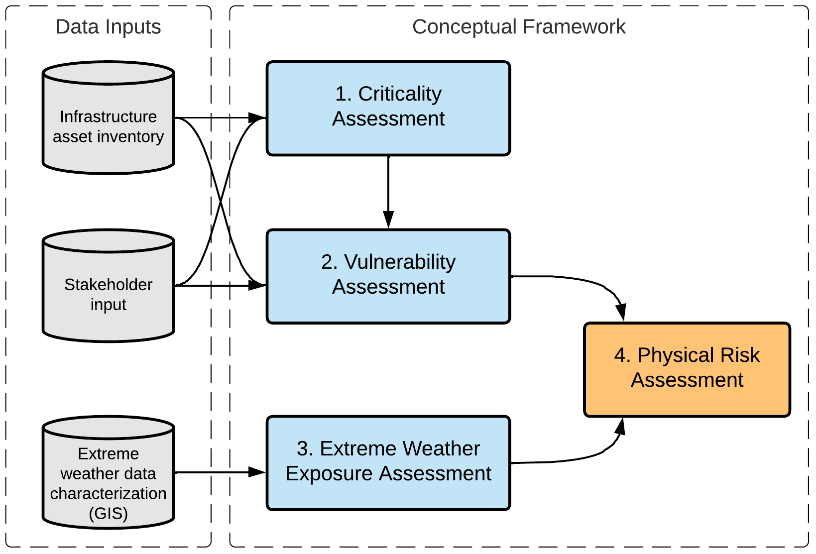
During my MSE studies, I worked on a project for the Texas Department of Transportation (TxDOT) titled, "Creating a Resilient Port System in Texas: Assessing and Mitigating Extreme Weather Events." This project contained many components, such as GIS database integration and outreach with state and federal agency officials and private industry representatives. In addition, I developed a conceptual risk assessment framework that employed stakeholder feedback, publicly available datasets, and attribute values to determine the criticality, vulnerability, and risk of the port transportation and supporting infrastructure systems. This subject became the topic of my MS thesis "Resilience through risk assessment: a conceptual framework for extreme weather risk assessment of the Texas port system".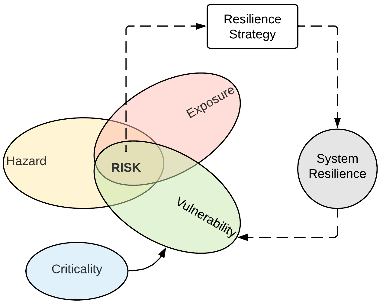

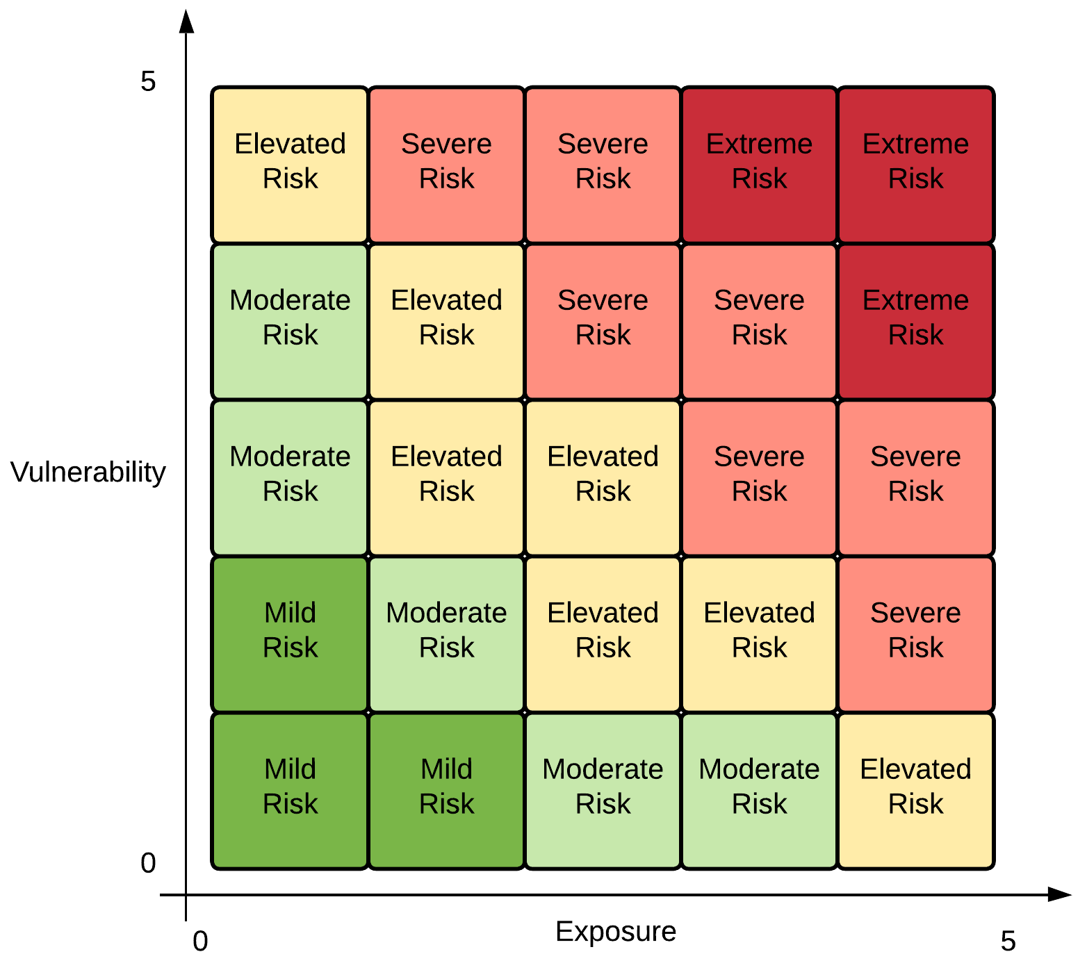
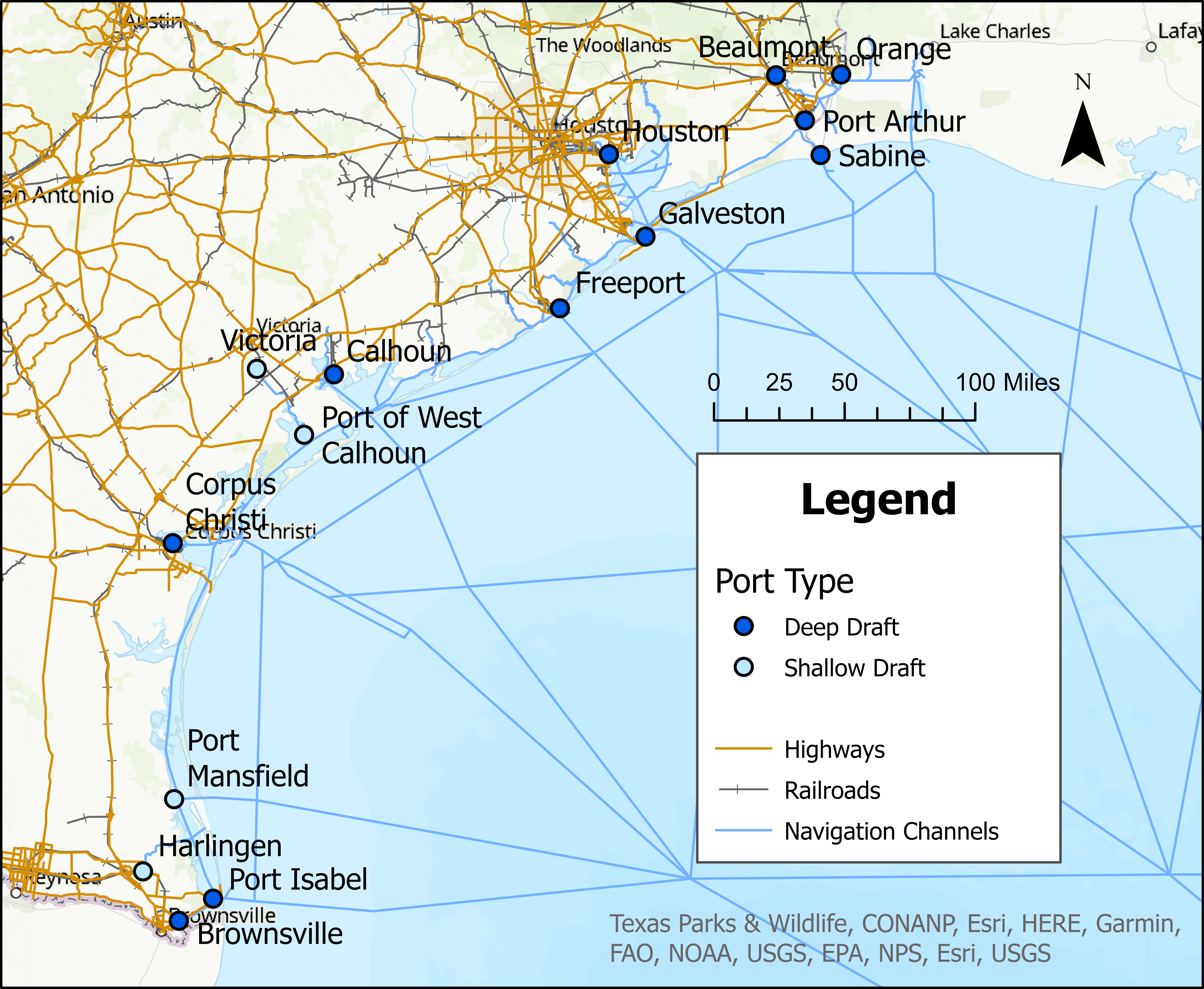

Further work completed under this TxDOT project included an assessment of the economic impacts of port closures due to different intensity hurricanes. An Excel tool, PortRESECO, was developed to allow port stakeholders to input data to determine the resilience of their own port facilities. The tool also contains a component that allows the user to view the results of the economic assessment of hurricanes on specific Texas ports. Complex network analysis was performed to assess the resilience of the integrated port system. By computing network metrics such as betweenness centrality, the topological properties that may influence robustness of the complex roadway, railway, and maritime channel networks was determined. Finally, a list of recommendations was provided to Texas port authorities, state government officials, and TxDOT to enhance the current levels of Texas seaport resilience. To read the full methods, results, and recommendations from this study, please view the research report in the CTR Library.
I have since extended this work to further examine the topics of port system capacity and resilience in a project sponsored by the US Army Corps of Engineers Research and Development Center (ERDC). This project combines AIS analysis with discrete event simulation methods to provide a data-driven method that can be used to assess the potential capacity and resilience impacts of different expansion or disruption scenarios. This work is ongoing and nearing completion, but portions have been presented at INFORMS 2024 and TRBAM 2025. This topic also comprises the bulk of my doctoral dissertation.
Hurricane Evacuation Traffic Analysis and Safety Assessment
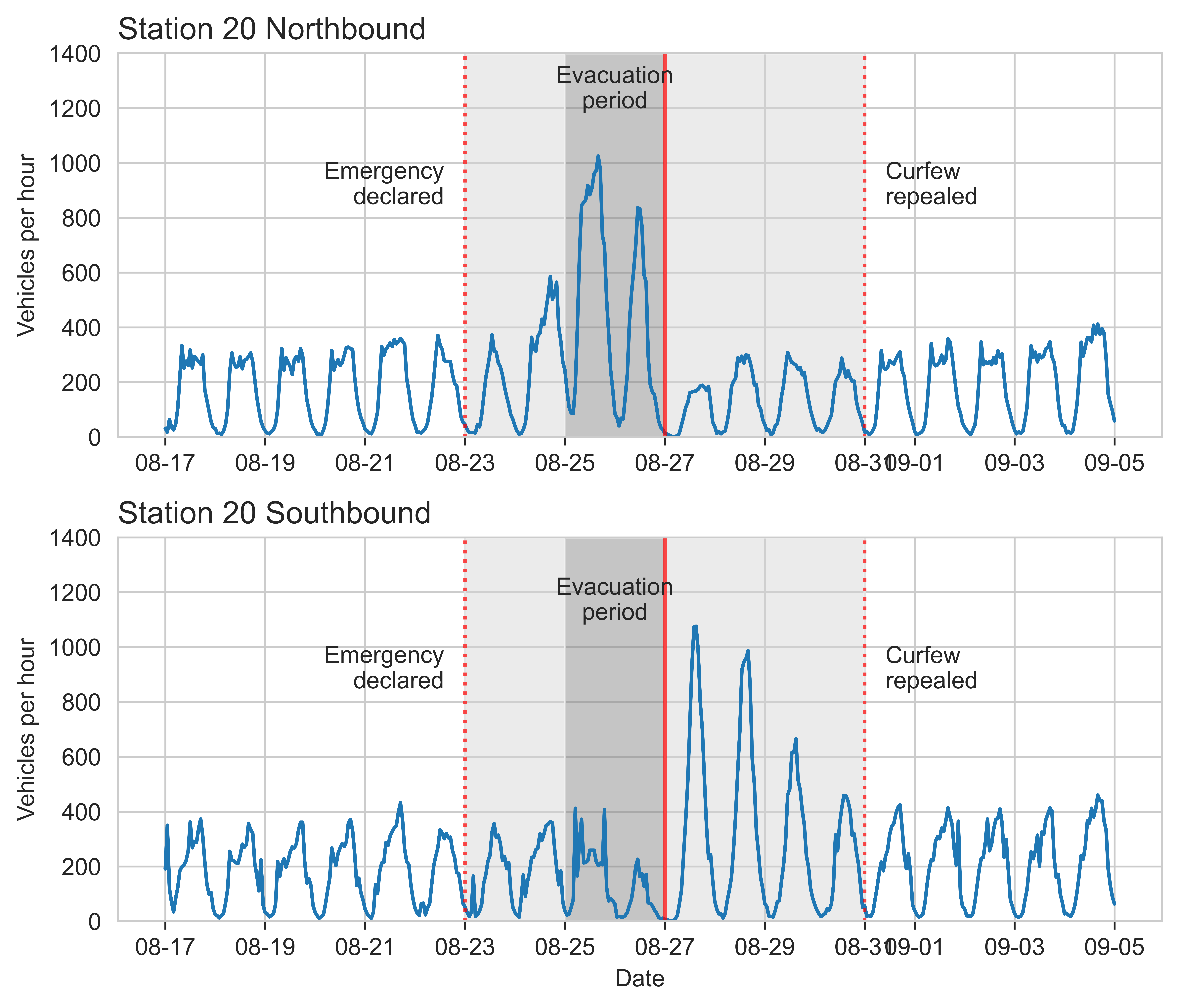
Evacuations are commonly implemented to safely relocate individuals from areas that may be exposed to hurricane hazards. Studying ways to improve evacuation efficiency and reduce delays is important to ensure that everyone is able to leave in advance of a storm's landfall. I conducted a research project for TxDOT examining the use of real-time information during hurricane evacuations, the project research report is available at the CTR library. As part of this work, we designed, distributed, and analyzed a survey of past Texas hurricane evacuees to better understand how they gather and use real-time data during a hurricane evacuation. We wanted to understand what information sources are used, what the data is used for during the evacuation, and how the real-time traffic monitoring and information dissemination systems used in the state may be improved. This work was published in TRR and won an award for Best Paper of 2023 for the Standing Committee on Disaster Response, Emergency Evacuations, and Business Continuity (AMR20). In other aspects of this project, we used network analysis and simulation techniques to formulate user equilibrium and maximum flow problems to identify locations for traffic monitoring device installation. We also applied traditional asset management techniques to estimate the installation and maintenance costs of traffic monitoring devices for use in hurricane evacuation scenarios.I have also studied traffic safety during evacuations, which is important to help reduce roadway incidents which may cause delays. I have worked with empirical crash and traffic volume data to assess evacuation crash frequency using time series decomposition and other statistical methods. The image below shows traffic volumes at a count station on US 287 in Texas during the Hurricane Laura evacuation in 2020.
